|
|
|

|
Southwest USA 2006
July 7th - August 2nd 2006
|
|
|
Saturday, July 8th
|
N/A
|
Sacramento, CA
|
|
|
Weather: Hot and sunny
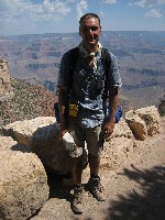
The weekend before the business begins in Sacramneto, leaving some time for sightseeing.
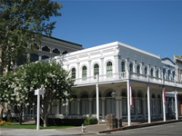
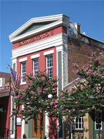
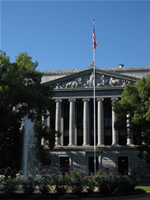
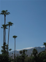
Sacramento, the capital of Califonia since 1854, is the 7th largest city in the west coast state with 450,000 folks calling it home.
The city was founded in 1848 by John Sutter and saw its first boom during the gold rush era in the late 1840s.
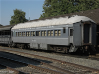
A large part of the old city has been retained and restored, becoming a major tourist attraction with cobblestone streets, historic buildings as well as the California State Railroad Museum.
The city is located at the confluence of the Sacramento River and the American River, and thus is often nicknamed River City, or, due to the the great effort put into parks and greening, the City of Trees.
|
Sacramento
|
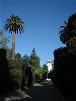
Capitol Park in Sacramento
|
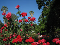
Capitol Park in Sacramento
|
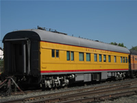
Railroad Museum in Sacramento
|
Old Sacramento
|
Old Sacramento
|

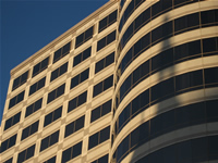
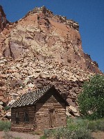
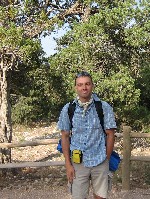
Arnolds workplace in Sacramento
|
Sacramento
|
Take me back to the...
[Top]
|
|
Sunday, July 9th
|
N/A
|
|
Sacramento, CA (~7:00 PT))
--->
San Francisco, CA
--->
Sacramento, CA (~19:00PT)
|
|
|
Weather: Warm and sunny - but guess where there was fog
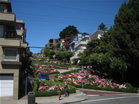
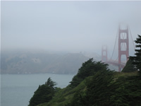
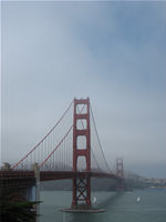
Today, with the conerence reception only kicking off the business part of the trip tonight, I took a day trip to San Francisco.
I hopped on an Amtrack train along the Capitol Corridor route to get there at 7am, and took a Greyhound bus from the TransBay Terminal back at 5pm.
I managed to walk around most of the coastal downtown area, passing by Pier 39, the Transamerica Pyramid, Little Italy (were a large number of restaurants were hosting world cup final viewing parties), Lombard Street and Fishermans Wharf and then rented a bike for a ride across the Golden Gate Bridge - which unfortunatley but not uncharacteristically - was wrapped in fog.
The city of San Francisco, home to around 750,000 people (over 4,000,000 in the metro area), is Californias fourth largest and ranks 14th in the US.
San Francisco is physically strongly characterized by its months-long episodes of fog, its steep rolling hills, its eclectic mix of architecture, and being surrounded on three sides by the Pacific Ocean and the San Francisco Bay.
First settled by the Spaniards in 1776, the United States claimed the city on January 30, 1847, during the Mexican-American War.
San Francisco began explosive growth with the advent of the gold rush in 1848.
The city also saw a large influx of Chinese immigrants - not without racial tensions in the late 19th and early 20th century.
Located near the San Andreas and Hayward faults, two major sources of earthquake activity in California, the city was practiaclly destroyed by a major earthquake on April 19th, 1906.
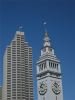
Famous landmarks of the city include the Transamerica Pyramid, the cable cars, the San Francisco-Oakland Bay Bridge and the Golden Gate Bridge, completed in 1936 and 1937 respectively, as well as the infamous Alcatraz island jail.
|
Ferry Building, San Francisco
|
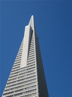
Transamerica Pyramid
|
Grace Cathedral
|
San Francisco
|
Lombard Street
|
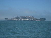
Alcatraz
|
San Francisco
|
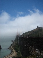
Golden Gate Bridge
|
Take me back to the...
[Top]
|
|
Thursday, July 13th
|
|
256 miles driven
|
|
Sacramento, CA (~9:00 PT))
--->
Cameron Park, CA (~10:00PT)
--->
Groveland, CA (~1:30PT)
--->
Yosemite National Park, CA (~3:00PT)
|
|
|
Weather: Hot and sunny
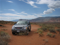
The vacation begins with the pickup of my Chevy Envoy 4WD SUV at Sacramento ariport at 8:45.
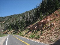
I take the scenic route to Yosemite, heading east on highway 50 from Sacramento and stopping in Cameron Park to purchase the essential styrofoam cooler befroe I turn off heading south onto highway 49.
Highway 120 then is a beautifully twisty drive towards the Big Oak Flat Entrance Station of Yosemite, which I reach at 3pm after a stop for a late lunch in Groveland.
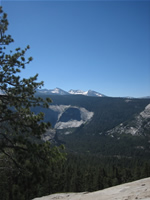
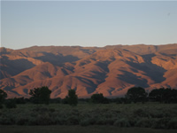
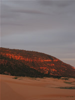
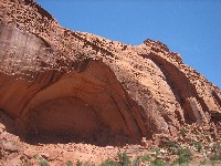
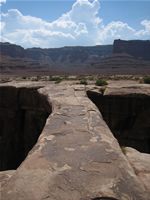
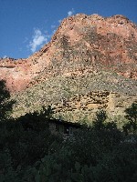
I set up camp at Crane Flat Campground and head off to the valley to get a first impression of the spectacular scenery, such as the Bridalveil Falls, El Capitan and end the day with a short hike to the Mirror Lake.
The golden hour of sunset casts the granite rocks of Yosemite in beautiful hues of orange as I make my way back up and out of the valley towards my waiting sleeping bag.
|
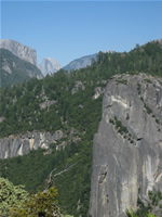
Yosemite
|
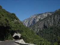
Tunnel along Big Oak Flat Road
|
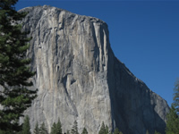
El Capitan
|
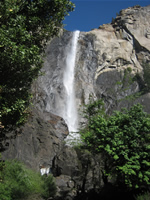
Bridalveil Falls
|
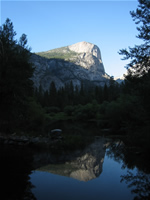
Half Dome in Mirror Lake
|
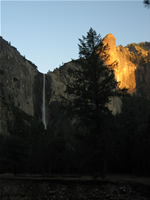
Sunset over the Bridalveil Falls
|
Take me back to the...
[Top]
|
|
Friday, July 14th
|
264 miles driven
|
|
Crane Flat CG, Yosemite, CA (~5:15 PT))
--->
Trailhead Parking, Yosemite Valley (~6:45 PT))
--->
Mist Trail->John Muir Trail->Half Dome (11:20-12:30 PT)->John Muir Trail->Mist Trail
--->
Trailhead Parking, Yosemite Valley (~3:45 PT))
--->
Lone Pine, CA (~9:00PT)
|
|
|
Weather: Hot and sunny
The cell phone alarm goes off at 5:15 and I take down the tent and am on the road to the valley by 6:20.
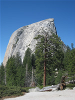
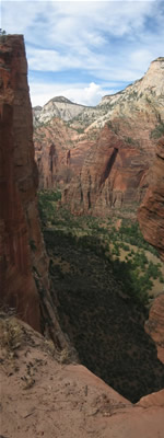
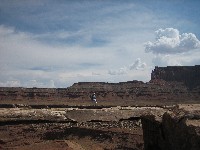
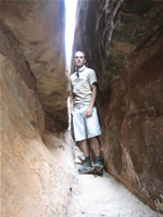
Starting the 17-mile/28km long hike to the peak of Half Dome at 7:00 along with a very diverse groups of folks with the same goal.
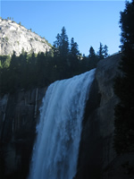
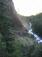
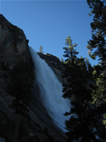
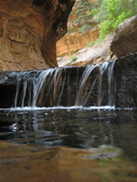
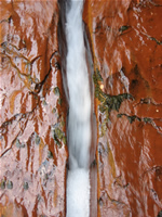
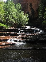
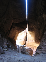
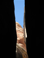
The hike is very scenic, passing by the Emerald Pool, Vernal and Nevada Falls and though varied vegetation of white and red firs.
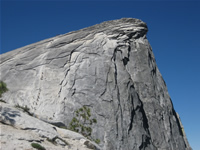
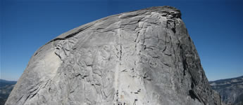
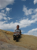
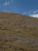
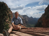
There are some pretty steep switchbacks to navigate, but the culmination is the final ascent up the more than 45 degree inclined granite wall onto the Half Dome via steel cables and wooden footrests.
I admit this last part of the ascent did get my heart rate up, primarily out of worry of getting back down.
It turns out though getting down isn't at all difficult, so no need to worry!
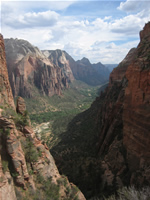
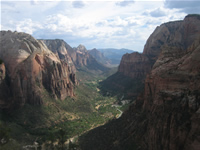
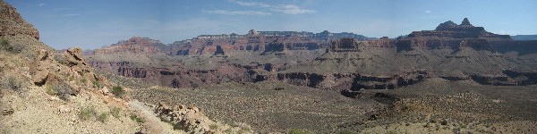
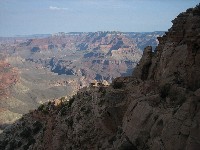
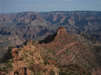
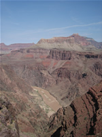
The view from the top over Yosemite Valley is breathtaking.
The hike is definitely not easy due to some pretty steep, even if pretty well maintained trails and the last but off pulling yourself up the dome.
Vertigo should not be something you fear if you're doing this.
I take the same route back down, electing to go for the complimentary misting thanks to the falls along the Mist Trail, instead of the alternative use of the John Muir trail all the way to the bottom.
I get back to the car at 3:45, after a pretty exhausting but fully rewarding, thrilling and beautiful 8:45 hour hike.
Sadly, my travel plan requires me to head out of Yosemite already.
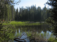
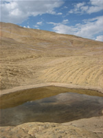
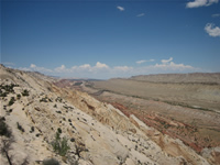
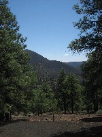
I leave by way of the Tioga Pass Road, which shows the other side of Yosemite: beautiful meadows, lakes and forested areas.
Even though the rest of the day is mostly driving, the scenery along highway 395, leading along the valley between the Sierra Nevada and the Amargosa Range, is quite beautiful in itself.
I call it a day in Lone Pine, CA, where I check into the Mt. Whitney Motel.
|
Vernal Falls
|
Mist Trail Morning
|
Nevada Falls
|
Yosemite Valley
|
Half Dome
|
Half Dome
|
Half Dome
|
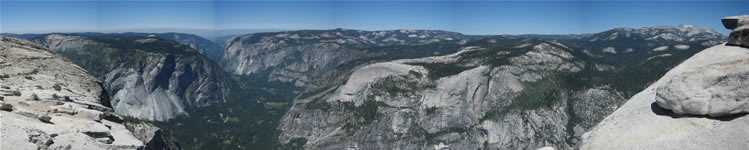
Panoramic view of Yosemite Valley from Half Dome
|
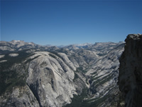
View of Yosemite Valley from Half Dome
|
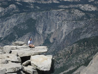
On the edge of Half Dome
|
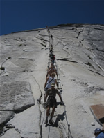
Cable descent from Half Dome
|
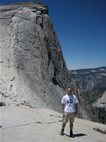
Half Dome
|
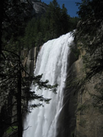
Thanks for the refreshing mist, Vernal Falls!
|
Yosemite
|
Inyo National Forest
|
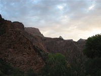
The Amargosa Range at sunset from Bishop, CA
|
Take me back to the...
[Top]
|
|
Saturday, July 15th
|
514 miles driven
|
Lone Pine, CA (~7:15)
--->
Death Valley National Park, CA (9:00-4:30)
--->
Las Vegas, NV (6:30)
--->
St George, UT (10:00 MT)
|
|
|
Weather: Hot and sunny
The cell phone alarm goes off at 6:15 and I'm checked out and on the rod by 7:15.
After picking up breakfast and drinks for the day at a gas station in Lone Pine, I head towards Death Valley National Park via Panamint Springs.
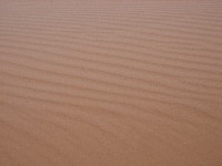
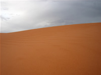
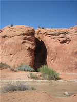
The first stop in sweltering Death Valley is a short hike among the sand dunes.
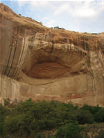
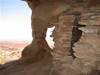
Just outside the northern entrance to the park is Scottys Castle, a unique vacation home constructed in the middle of the desert in the 1920s by Walter Scott and Albert Mussey Johnson.
Nearby, Ubhebe crater is evidence of volcanic activity in the valley.
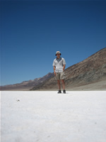
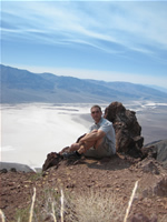
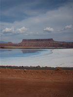
The lowest and often the hottest (120F during my visit) spot in the park can be found in the large salt pan at Badwater in the heart of Death Valley, which is 282 feet below sea level.
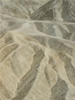
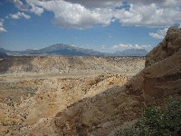
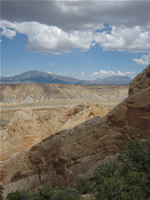
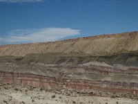
Artists Drive showcases an impressive palette of colors in the desert badlands of the Black Mountains bordering the salt pan on the east side.
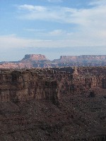
Zabriskie Point and Dantes View offer impressive views across Death Valley.
Leaving the heat of Death Valley behind, I head into Nevada briefly, for a quick dinner in Las Vegas, and then make my way into Utah, where I'll be spending the next week and a half.
I turn for the night at an EconoLodge in St. George, UT.
|
Sand Dunes
|
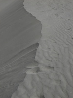
Sand Dunes
|
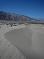
Sand Dunes
|
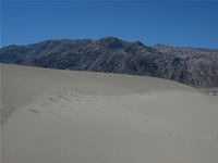
Sand Dunes
|
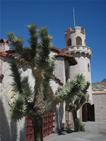
Scottys Castle
|
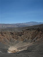
Ubhebe Crater
|
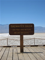
Badwater Basin
|
Badwater Basin
|
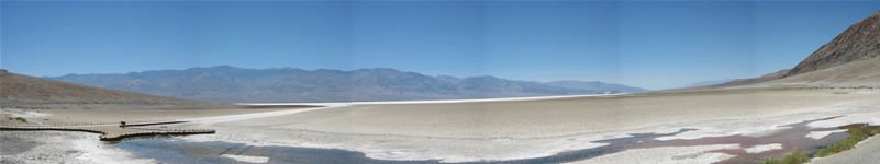
Badwater Basin Panorama
|
Badwater Basin
|
Painted Desert along Artists Drive
|
Zabriskie Point View
|
Dantes View
|
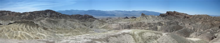
Panoramic view from Zabriski Point
|
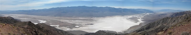
Dantes View Panorama
|
Take me back to the...
[Top]
|
|
Sunday, July 16th
|
234 miles driven
|
St George, UT (8:00)
--->
Cedar City, UT (10:00)
--->
UT14 through Cedar Canyon/Dixie National Forest (10:30-11:30)
--->
Tropic, UT (12:15)
--->
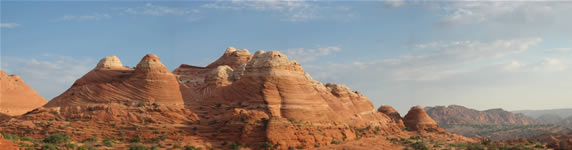
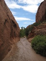
Cottonwood Canyon Road [Grosvenor Arch (12:30-1:00), Bigham Hill Road (2:00-2:30), Yellow Rock (2:45-5:30)]
--->
Toadstool Hoodoos (6:45-7:15)
--->
Page, AZ (9:30)
|
|
|
Weather: Hot and sunny
Cell phone alarm awakens me at 7:45 and I'm on the road at 8:00 after a complemntary motel breakfast.
Heading north from St George I stop in Cedar City to buy a tape adapter so I can hook my iPod up to the car for the not infrequent radio-free areas in the Southwest.
Heading east on highway 14 I wind my way through the very scenic and serene Cedar Canyon/Dixie National Forest, a popular recreation area in southwest Utah.
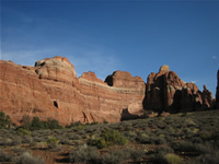
Passing by Bryce Canyon this time, which I visited - ok, maybe a little too briefly - last year I make my way towards the Grand Staircase Escalante National Monument.
I stop at the visitor center in the town of Cannonville, UT to enquire about conditions for the unpaved Cottonwood Canyon Road, which begins just south of the town and merges with highway 89 not far from Big Water, UT.
Cottonwood Canyon road usually is in pretty good shape to be driven even in a regular passenger car, and it is too for my drive south today.
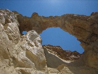
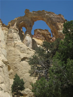
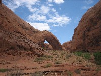
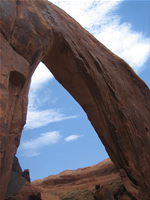
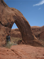
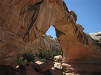
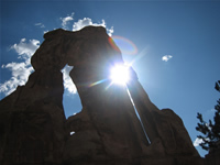
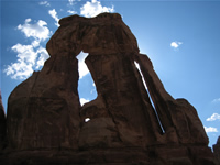
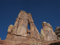
Just 12 miles south form the beginning of the road is the first highlight of the area, Grovenor Arch, in fact a double arch.
Despite what sounded like a very thourogh description in Laurent Matres excellent book, I can't seem to find what he (and some BLM rangers) refer to as Candyland.
Even on my second visit here a few days later, I manage to find some more of the landmarks he describes, including a relatively nice hike through a winding "slot" canyon, but fail to find the colorful badlands I'm looking for.
I guess a good excuse to come back here soon - but I hope I'll get a description for the dummies from Laurent then. :-)
Close to the southern end of Cottonwwod Canyon Road I do my first bit of real off-road 4WD driving onto the Bigham Hill road.
It's not too terrible to drive - I later even saw a passenger car coming back down from there, which I have to say found pretty brave - but high clearance would seem a good idea IMHO.
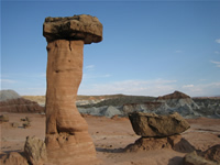
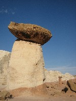
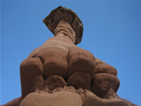
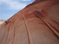
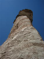
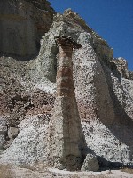
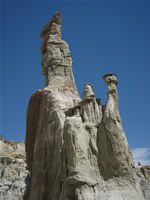
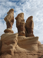
The view across the Cockscomb is worth the slow crawl up Bigham Hill Road, with the eye-catching color contrast of the Yellow Rock being a personal highlight for me.
After seeing it from the ridge on Bigham Hill Road, I can't pass up hiking towards it for a closer look after I get down.
The hike requires climbing up a relatively steep hill with some loose rocks. Not super difficult but a definitely a place to be careful of not twisting your ankle.
After that (well, you do need to come back down later) the hike is easily accomplished across slickrock.
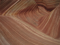
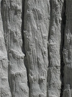
Yellow Rock itself is quite remarkable, reminiscent a little of the wonderful Wave, but yellow and not quite as delicate in appearance.
Exploring it is a fun experience, and I spen a good hour marveling at the unique blend of yellow, white and red rocks.
With still some daylight left after I pull out of Cottonwood Canyon Road, I decide to visit the Toadstool Hoodoos.
The day ends after a long wait for dinner at Pizza Hut at the Motel 6 in Moab, AZ.
|
Cedar Canyon
|
Grosvenor Arch
|
Grosvenor Arch
|
Candyland's gotta be here...somewhere
|
Cottonwood Canyon Road
|
View from the top of Bigham Hill Road
|
Yellow Rock
|
Yellow Rock
|
Impressed hiker on Yellow Rock
|
Yellow Rock
|
Yellow Rock
|
Yellow Rock
|
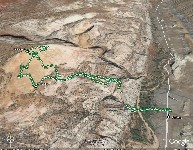
Google Earth View of my Yellow Rock Hike GPS Track
|
Toadstool Hoodoos
|
Toadstool Hoodoos
|
Toadstool Hoodoos
|
Take me back to the...
[Top]
|
|
Monday, July 17th
|
175 miles driven
|
Page, AZ (8:00)
--->
Wirepass Trailhead (10:00)
--->
[The Wave (12:30-1:00), North Teepees (2:00-2:30), The Wave (2:45-5:30)]
--->
Wirepass Trailhead (1:30)
--->
Valley of the White Ghosts (2:30-3:45)
--->
Springdale, UT (7:45)
|
|
|
Weather: Hot and sunny
An early start to the day at 5:00 and I'm off heading for the Wirepass Trailhead by 5:30.
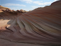
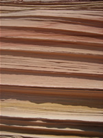
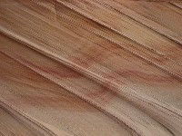
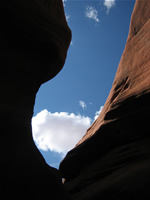
I begin my second visit to the wonderful Wave just as the sun rises and am the first person that day to hike into the Vermillion Cliffs from the Wirpass TH at 6:30.
Entering though the north entrance at 7:45 I am once again in awe of this natural wonder and have a whole hour to enjoy it all by myself before the next visitors arrive.
Having missed it the last time was here I explore the 2nd Wave, which I find to be quite beautiful even outside of the golden hour at sunset.
Using the shade of a large cloud, which thankfully though never managed to deliver rain, I hike over to the North Teepees, which are about 45 minutes to the east of the Wave.
After returning back from the Teepees I enjoy the Wave in the full sun again before I make my way back to the car.
Driving back towards highway 89 I hear about a severe t-storm warning for the area on the radio. Thankfully for the folks still out at the Wave the storm doesn't make it to the area though.
In the hot desert heat I visit an area referred to as the Valley of the While Ghosts just north of the highway.
After a dinner at Suway in Kanab, UT I drive thorugh Zion National Park and manage to get a nice camping spot right by the Virgin River at the campsite in Springdale, UT.
|
Crack of dawn at the trailhead
|
On the way to the Wave...
|
Tracks to the Wave
|

The Wave
|
Lucky resident of The Wave
|
The Wave
|
The Wave
|
The North Teepees
|

The North Teepees
|
The North Teepees
|
The 2nd Wave
|
The 2nd Wave
|
The 2nd Wave
|
Hamburger Hill
|
White Ghosts
|
White Ghosts
|
White Ghosts
|
White Ghosts
|
Take me back to the...
[Top]
|
|
Tuesday, July 18th
|
175 miles driven
|
Springdale, UT (6:50)
--->
Left Fork Trailhead (7:45)
[--->
Subway (10:30-11:30)--->Left Fork Trailhead (1:30)]
--->
Zion National Park (3:05)
[--->
Angels Landing Hike (3:45-6:30)]
--->
Coral Pink Sand Dunes State Park (8:00-8:30)
--->
Kanab, UT (9:15)
|
|
|
Weather: Overcast mornings, then hot and sunny
Motivated by the supposedly best lighting conditions at the Subway during mid-morning I get up at 6 and head for the Left Fork Trailhead.
The overcast skies worry me a bit, but thankfully I decide to start the hike anyway.
The route I choose is often referred to as "from the bottom", with the alternate route being possible only if you are into canyoneering and make use of ropes and other climbing equipment.
The clouds clear away soon, but at least afford me some shade on the hike dwon into the canyon.
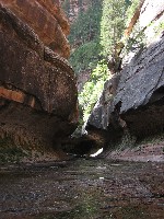
The hike out to the Subway involves a steep decent (and ascent upon return) into the canyon and frequent crossings of the North Creek on the 10 mile round trip.
Mostly a trail is visible or at least the most likely route easily guessed and the most difficult or strenuous part is the descent and ascent into the canyon.
Once at the bottom there really isn't much opportunity to get lost, as the North Creek pretty much leads the way.
There's probably just better and worse ways to go, depending on which side of the creek you choose.
Crossing the creek several times is unavoidable - with a little luck and watertight hiking boots, you can keep your feet dry though - but many people choose to wade to the Subway the entire way.
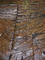
The hike itself isn't extremely scenic in itself, but the Subway is worth the trip.
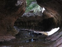
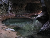
Arriving at the beautifully carved out tunnel-like canyon that forms this marvellous site at 10:30 I find I probably got there a little too late.
The beautiful pictures of luminous pools you can find on the web require only indirect light to penetrate into the Subway, which I probably just missed by a half hour.
Nevertheless the unique pools in the heart of the Subway are fun to explore even now and the famous and beautiful shot of water shooting through a crack in the red bedrock just before the mouth of the Subway is possible to get.
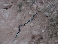
In total I see three black and white striped snakes on my hike, which are thankfully more afraud of me than I am of them.
The afternoon I spend in Zion National Park.
Parking at the visitor center I take the shuttle bus service to the Grotto stop and do the steep hike up to Angels Landing.
The last part of it could be a little scary fro people prone to vertigo as it leads up narrow ledges with chains offering something to hold onto.
The view near the top is quite spectatcular though. The breathtaking view past the red ridges lining Zion Canyon really makes Zion one of my persoanl favorites in the region.
On my way to Kanab for the night I find a nice pullout to view the sunset illumintae the Coral Pink Sand Dunes.
Somewhat suboptimal due to some large grey clouds blocking the sun I do get a nice impression of the pink and red glow of the dunes and rocks at the golden hour.
|
The Subway
|
The Subway
|

The Subway
|
The Subway
|
The Subway
|
The Subway
|
The Subway
|
The Subway
|
Angels Landing
|
Angels Landing
|
Angels Landing
|
Angels Landing
|
Coral Pink Sand Dunes
|
Coral Pink Sand Dunes
|
Coral Pink Sand Dunes
|
Take me back to the...
[Top]
|
|
Wednesday, July 19th
|
207 miles driven
|
Kanab, UT (10:15)
--->
Cottonwood Canyon Road (12:00-2:00)
--->
Kodachrome State Park (3:00-4:00)
--->
Escalante, UT (5:00)
--->
Lower Calf Creek Falls Hike (7:00-9:00)
--->
Escalante, UT (9:00)
|
|
|
Weather: Hot and sunny, with heavy early afternoon monsoon showers
Today I treat myself to a bit more sleep, getting up at 8 and only being on the road north at 10.
I head north on highway 89 and again drive past Red Canyon and Bryce for a stop at the GSENM visitor center in Cannonville, UT.
I had lost my sunglasses a few days ago and was reasonably certain it must've happend at the Grosvenor Arch.
The rangers were very helpful, calling around the area to find out if they had been returned to another station, but without luck.
If they ever do turn up, they said theyd mail em to me.
Somewhat impulsively I decide to go back to Grosvenor Arch and see if I find them lying around there. No big surprise, I don't find them.
I head south on Cottonwood Canyon Road for a few miles and try again to find Candyland, as described by Laurent Martres.
Still no luck there either, but I do see more of the described landmars and do a nice short hike in a slot canyon there.
With rainclouds moving in I only get a short impression of the often highly-praised Kodachrmoe State Park just north of Cottonwood Canyon Road.
As I drive east on highway 12 the t-storms finally begin dumping heavy rain on the area.
I reach the GSENM vistor center near Escalante just as the rains taper off, where I enquire about likely road conditions of the Hole-in-the-Rock road and buy myslef a topo map for the planned hikes along it tomorrow.
I check into the Prospector Inn Motel in Escalante before I drive further east on highway 12 towards the trailhead for the Lower Calf Creek Falls.
Turns out the late time of day is truly quite good for this hike, with some very beautiful lighting along the way.
I meet two college kids from Colorado on the hike, who are currently into their third week of a planned 7-week bicycle ride from San Francisico to NYC.
Even if they kight not be able to see as much along the way as people traveling by car, I'm sure they'll have a blast and a very memorable journey.
Before I call it a night a grab a sandwich from the motel restaurant for dinner.
|
Kodachrome
|
Kodachrome
|

Kodachrome
|
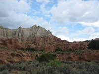
Kodachrome
|
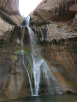
Lower Calf Creek Falls
|
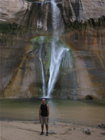
Lower Calf Creek Falls
|
Lower Calf Creek Falls
|
Lower Calf Creek Falls
|
Take me back to the...
[Top]
|
|
Thursday, July 20th
|
101 miles driven
|
Escalante, UT (7:30)
--->
Hole in the Rock Road [Devils Garden (8:30-10:00), Broken Bow Arch (11:30-2:00), Dance Hall Rock (2:45-3:00), Peek-A-Boo Canyon (3:45-5:45)]
--->
Escalante, UT
|
|
|
Weather: Hot and sunny, monsoon clouds and winds in the evening
The day starts off relatively early at 6:30, and after picking up breakfast at a gas station I head off for Hole in the Rock Road.
The plan, as recommended by the rangers in the visitor center, is to get started down Hole in the Rock Road with Devils Garden and only continue further south if the weather stays dry.
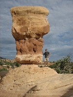
Devils Garden is just a few miles south on HITRR and features a alrge collection of photogenic hoodoos as well as two small arches.
It turns out my Garmin map hast Metate Arch marked at the wrong coordinates, so I take quite a while before finding this beautiful place myself.
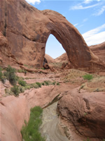
The weather is lovely, so I head quite a ways down south on HITRR to the trailhead for the Broken Bow Arch.
The roughly 1 hour hike to and from this spectacular large arch involves hiking in a wash and along a stream which actually has quite a bit of water after the rains yesterday.
This time I don't quite manage to keep my feet dry. Broken Bow Arch suddenly pops up rounding another loop in the wash and is truly quite breathtaking.
After Broken Bow, I drive back north on HITRR and stop for a while to check out Dance Hall Rock, a natural amphitheater which was used as a camp by the mormon settlers scouting out this road as an access to the Coloroado.
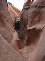
Peek-A-Boo slot is one of three slot canyons located adjacant to each other on the east side if HITRR.
I elect to only explore this canyon on its own, not trekking over to Spooky Gulch, as is very often done.
The primary entry to Peek-A-Boo involves climbing up a rock, aided by a tree trunk. However a large puddle right in front of the entry makes it impossible for me to climb up due to the mud on my shoes.
Instead I hike up and around to the middle of the canyon for a secondary point of entry towards the middle of Peek-A-Boo.
This slot canyon is a lot of fun, with some very tight passages and fun climbs. It gets tight enough at one point, that I have to leave my backback behind to get through to the end of the slot.
After a thoroughly enjoyable hour exploring the canyon, I make my way back up towards the car.
Dark clouds have moved over the GSENM and pretty strong winds blow a lot of dust around, which convince me that the hike to Sunset Arch I had pencilled in is probably not the best idea.
Instead I head back to Escalante for a nice dinner at a local restaurant called Cowboy Blues.
|
Devils Garden
|
Devils Garden
|
Metate Arch in Devils Garden
|
Broken Bow Arch
|
Broken Bow Arch
|
Broken Bow Arch
|
Broken Bow Arch
|
Broken Bow Arch
|
Broken Bow Arch
|
Dance Hall Rock
|
HITRR
|
Peek-A-Boo Slot
|
Peek-A-Boo Slot
|
Peek-A-Boo Slot
|
Take me back to the...
[Top]
|
|
Friday, July 21st
|
172 miles driven
|
Escalante, UT (9:45)
--->
Boulder, UT (11:30)
--->
Burr Trail (12:00-1:00)
--->
Capitol Reef National Park [Strike Valley Overlook (1:15-3:00), Notam-Bullfrog Road (3:00-6:45)]
--->
Burr Trail (6:45-7:30)
--->
Boulder, UT (7:30-8:00)
--->
Torrey, UT (9:00)
|
|
|
Weather: Hot and sunny, nighttime thunderstorms
I start the day at 8:00 and have breakfast (tasty chocolate chip pancakes) at the motel restaurant.
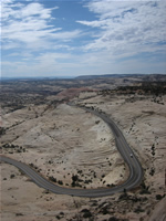
I'm checked out and on the road by 9:45 and enjoy the truly spectacluar scenery driving east on highway 12 towards Boulder, UT.
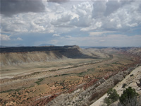
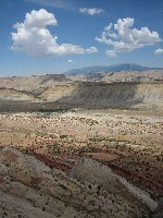
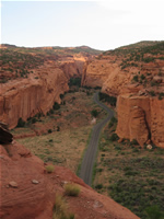
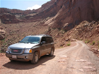
From there I take the equally beautiful drive through spectacularly rugged terrain along the Burr Trail, which leads into the southern part of Capitol Reef National Park.
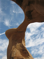
Just after entering Capitol Reef a 3 mile 4WD road leads off to the north to the trailhead from which a short and a longer hike lead to the Strike Valley and Upper Muley Twist overlooks respectively.
This road is definitely one where the high-clearance of a 4WD vehicle is a must, as it gets very rough quickly.
It's not very hard to drive though, with the main difficulty being the smart navigation between rocks and boulders of various sizes along the road.
A parking area at the end of the road is the start of a relatively well cairned hiking trail to the Strike Valley overlook, which offers truly breathtaking views across the Waterpocket Fold of the southern Capitol Reef.
Back on the Burr Trail I drive further into Capitol Reef down the Burr Trail switchbacks into the valley below.
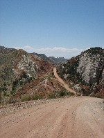
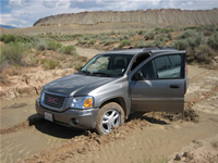
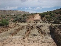
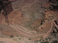
Notam-Bullfrog road is a dirt road that connects the Bullfrog marina on Lake Powell in the South with highway 24 to the north.
Usually not particularly difficult to drive I learn today what all the warnings regarding the impact of rain on road quality is all about...
After almost getting stuck in a muddy wash myself (thankfully backing up works and I make it through it in my second attempt) I find another (4WD!) vehicle stuck just one muddy wash fruther north.
A belgian familt had been trying in vein to get out of the predicament for two hours and were extremely happy to have another vehicle drive by.
Just as we decide to head south towards the Bullfrog Marina to get help, another van pulls up behind us.
Now, at the initiative of the tour leader of the french group in the van, we begin to jack up the car, dig it free and build a makeshift road under its tires using collected rocks.
With four belgian, six french and my own pair of hands working away we put in an hour of work, which thankfully and to the elation of all of us allows the car to reverse back out of the mud.
Naturally, we all drop the plan to continue heading north on Notam-Bullfrog road and instead decide to head back via the Burr Trail to Boulder and onwards from there.
Almost comically, in the wash I had almost become stuck in a few hours before, we find a passenger car stuck in the mud.
With the idea of founding "Capitol Reef Rescues" thankfully all it takes to get this car back on its way is a good push by all of us.
Extremely grateful for the help, the Belgians invite the "Capitol Reef Rescues" gang to a pizza dinner in Boulder, after which we all head north.
I reach Torrey, UT just after sunset and get a camping spot on a campsite for the night.
|
Highway 12
|
Burr Trail
|
Strike Valley Overlook
|
Strike Valley Overlook
|
Strike Valley Overlook
|
Notam-Bullfrog Road
|
Notam-Bullfrog Road
|
Notam-Bullfrog Road
|
Notam-Bullfrog Road
|
Burr Trail
|
Burr Trail
|
Highway 12
|
Take me back to the...
[Top]
|
|
Saturday, July 22nd
|
218 miles driven
|
Torrey, UT (9:00)
--->
Capitol Reef National Park [Cassidy Arch (11:00-1:00), Scenic Drive, Fruita Schoolhouse, Hickman Bridge (2:30-3:45)]
--->
Caineville Wash Road [Cathedral Valley/Temple of the Sun and Moon (4:15/5:00-5:45/6:15])
--->
Moab, UT (8:15)
|
|
|
Weather: Overcast morning, hot and sunny during the day
I start the day at 7:45 and have mr car changed from acmping mode back to drive mode by 9.
I pick up breakfast at a bakery in Torrey before I head into Capitol Reef Nation Park, with the first stop being the visitor center.
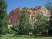
After enjoying the colorful contrast of the rich green valley with the red rocks in the Fruita area I drive the first part of the Scenic Drive and then turn off onto the Grand Wash.
From there I hike up towards Cassidy Arch, where I run into the french part of the Capitol Reef Rescue team, who are also spending the day in Capitol Reef.
Upon returning from the Arch I drive the rest of the Scenic Drive towards the end of the paved road at Capitol Gorge.
Due to the rains in the past few days Capitol Gorge is unfortunately impassable, so I have a brief picnic before heading back north along the scenic drive.
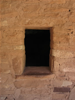
After a short stop at the visitor center, where a ranger kindly contacts a ranger in the field to confirm that driving on Caineville Wash road towards Cathedral Valley is safe, I briefly visit the Fruita schoolhouse and nearby Petroglyphs.
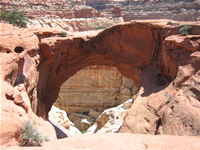
Another highlight of Capitol Reef is the Hickman Bridge, which can be visited on a short hike.
After the lesson learned on Notam-Bullfrog Road yesterday I am fortunate that two cars just pull out of Caineville Wash Road as I reach, so I can get up-to-the minute clearance about the passibilty of the road.
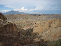
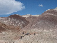
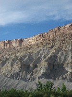
Driving north towards Cathedral Valley, some spectaculr desert badlands or varying color line the road.
While rough, the road is thankfully not adversaly impacted by the recent t-storms and I am fortunate to be able to experience the beauty of the Temples of the Sun and Moon as well as the unique Glass Mountain.
Having been lucky to actually see all I had hoped to on my visit to Capitol Reef after all, I set out on a long drive north and east to reach Moab, where I make a Motel 6 my home for the next two nights.
|
Fruita Oasis
|
Fruita Schoolhouse
|
Cassidy Arch
|
Hickman Bridge
|
Welcome to Mars: The Caineville Wash Road to Cathedral Valley
|
Glass Mountain
|
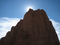
Glass Mountain
|
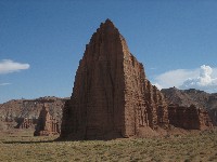
Temple of the Sun and Moon
|
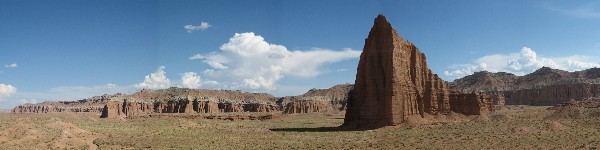
Panoramic view of the Temple of the Sun and Cathedral Valley from Glass Mountain
|
Temple of the Sun
|

Temple of the Moon
|
Temple of the Moon
|
Welcome to Mars: The Caineville Wash Road to Cathedral Valley
|
Badlands along Highway 24
|
Take me back to the...
[Top]
|
|
Sunday, July 23rd
|
118 miles driven
|
Moab, UT (7:30)
--->
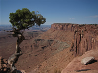
Canyonlands Island in the Sky [Grandview Point (9:00-11:00), Mesa Arch, Upheaval Dome (12:00-12:50), Aztec Butte (1:05-2:15)]
--->
Shafer Trail (2:30-3:15), White Rim Road [Gosseneck Overlook (3:30-3:45), Musselman Arch (3:55-4:10)], Potash Road (4:30-6:00)
--->
Moab, UT (6:00)
|
|
|
Weather: Hot and sunny
My cell again wakes me early, at 6:15, and after a pancake breakfast at Dennys, I head for my second visit to the Island in the Sky district of Canyonlands National Park.
Even on the second visit, the views along Grand View Point are breathtaking. I manage to find the little tree on the rim that was the protagonist in one of my favorite shots from last years visit.
Similarly, Mesa Arch precarious location on the edge of the Island in the Sky is as fabulous this time - I was too lazy to make it here for the sunrise though.
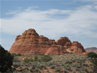
Firsts on this trip are my hikes up to the Upheaval Dome and onto Aztec Butte, where a series of very photogenic ancient indian granarys perched on the edge of the Butte are worth the somewhat difficult climb.
Much sooner than I had hoped the last time, the plan to drive down Shafer Trail in a 4WD vehicle (one of the main reasons I rented it this time) can be realized.
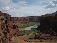
Not technically difficult to drive in a high clearance vehicle, but a hell of a lot of fun I enjoy every minute of my descent doen Shafer Trail and continue on White Rim Road for a bit, stopping to marvel at the view from the Goosenecks Overlook and Musselman Arch.
Musselman Arch is as far as my one-day trip permits me to explore the White Rim Road, so I turn back and make my way back to Moab via the Potash Road.
|
Grand View Point: Reprise
|
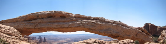
Mesa Arch Panorama
|
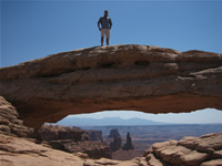
Atop Mesa Arch
|
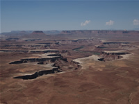
Green River Overlook
|
Aztec Butte Granary
|
This time I'm doing Shafer Trail!!
|
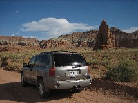
Chevy on the Shafer Trail
|
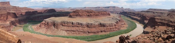
Panoramic view of the Colorado from Goosenecks Overview on White Rim Road
|
Musselman Arch off of the White Rim Road
|
Musselman Arch (White Rim Road)
|
More Colorado Goosenecks along Potash Road
|
Potash Mine along Potash Road - maybe there's a link there? ;-)
|
Take me back to the...
[Top]
|
|
Monday, July 24th
|
95 miles driven
|
Moab, UT (8:00)
--->
Hole-in-the-Rock (10:00)
--->
Canyonlands Needles, UT (11:00)
--->
Elephant Hill Trailhead (12:00), Cheslar Park Trail, Joint Trail, Cheslar Park, Druid Arch (5:00-5:30), Elephant Hill Trailhead (7:30)
--->
Squaw Flat CG, Canyonlands Needles (7:45)
|
|
|
Weather: Hot and sunny, clouds and distant t-storms in the evening
I start the day a little later today and browse around downtown Moab a bit before I head south towards the Needles district of Canyonlands.
I arrive at the visitor center and make sure my plan of hiking the Cheslar Park and Joint Trails is possible. The ranger gives me all the details necessary and also suggests I could try to add a visit to the Druid Arch to my hike.
Beginning at the Elephant Hill Trailhead, unfortunately right in the midday heat, I still thouroughly enjoy the rugged but mostly well-cairned trail through the beautiful Needles.
One highlight is definitely the narrow slots on the southern connection of the Joint Trail to Cheslar Park.
A large cavelike room, only lit through a narrow slit in the ceiling is a perfect place for a rest, and the hundreds of creative cairn towers built here are evidence of the breaks taken here bu many hikers before me.
Having made good time I do decide to add the detour south to view the Druid Arch, which is often named as one of the most beautiful arches in the Southwest.
The hike there is strenuous but well marked thorugh cairns. The hardest part is the last climb up towards Druid Arch.
The mean part about it is that my GPS was already beeping, telling me I was there, but I was having a gard time believing that as I clung to the rocks on the mountain.
However just turning your head hear will reveal the beautiful arch high up on a ledge.
Enjoying the late-afternoon sun peering through the two openings of Druid Arch for a while I climb back down and hike around to see the now-lit rear of the arch.
I then begin hiking back towards the trailhead, slowly feeling the hard hike through the rugged terrain behind me.
I set up camp at Squaw Flat Campground, again using the large space afforded by folding over the seats on my Chevy Envoy.
I do try to get a sunset view of the mesas of the Island in the Sky from the Slickrock Trail, but clouds don't create the otherwise spectacular red glow on the cliffs tonight.
|
Needles near Cheslar Park
|
Bizarre landscapes to the west of Cheslar Park
|
If not yet named, I'd suggest Enterprise Rock
|
Cairn City on the Joint Trail
|
Cairn City on the Joint Trail
|
Tight Fit along the Joint Trail
|
Tight Fit along the Joint Trail
|
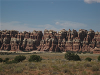
The Needles in Cheslar Park
|
Druid Arch, easy to miss...
|
...but remarkable to see.
|
The back of Druid Arch in the afternoon sun
|
A long but memorable day among the Needles ends
|
Take me back to the...
[Top]
|
|
Tuesday, July 25th
|
367 miles driven
|
Canyonlands Needles (7:30)
--->
Newspaper Rock (9:45)
--->
Butler Wash Ruins (11:40-12:00)
--->
Mule Canyon [House on Fire] (12:15-1:30)
--->
Road Canyon [Fallen Roof Ruin] (2:30-3:45)
--->
Muley Point (4:00-4:15)
--->
Moki Dugway
--->
Mexican Hat, UT (4:45-5:30)
--->
Cameron, AZ (6:45 PT)
--->
Mather CG, Grand Canyon, AZ (8:00 PT)
|
|
|
Weather: Hot and sunny
I get up real early at 5:45 in order to ry to catch the spectacle of sunrise over the Needles viewed from the Big Spring Trail just off of the campground, but sadly last nights clouds are still around.
I check out the roadside highlights in the Needles district of Canyonlands (Wooden Shoe Arch, Roadside Ruins, Slickrock Trail) before I end my visit to Canyonlands and head back towards highway 191.
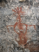
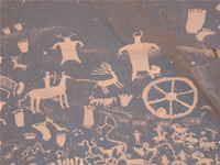
Just outside of Canyonlands on the way is Newspaper Rock, which features a large number of very well preserved indian petroglyphs.
Via Monticello I turn west off of highway 191 onto highway 95 to cross the Butlar Wash and Comb Ridge.
The Cedar Mesa features a large number of ancient indian dwellings and granaries.
An easily accesible one, the Butlar Wash Ruins, can be found just 11 miles from the beginning of highway 95.
A well maintained 1-mile hiking trail leads to an overlook, where a dwelling is visible in a grotto of a canyon.
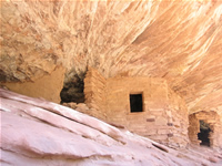
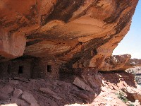
Somewhat more out-of-the-way and less known, but still quite easy to reach are some very photogenic ruins in a cliff overhang of the South Fork of Mule Canyon, a few miles further west on highway 95.
This is BLM maintained land, requiring a self-pay fee of $2. After a 1 mile hike along a wash, the unique puebloan dwellings come into view on the right side, and due to some unquiue rock structure in the overhang are really very nice to view.
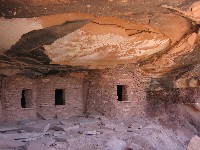
Another little known wonder, Road Canyon, is located some 13 miles south of highway 95 just off of highway 261.
This is again land administered by the BLM, which ask for $2 self pay contribution.
A roughly 2 mile hike down into the canyon, along a wash followed by a climb up slickrock will get you to a cliff overhang at the top of the canyon, which has a number of quite scenic dwellings.
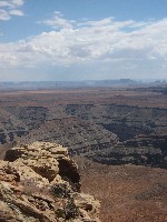
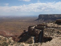
Traveling further south on highway 261 I take the dirt road just prior to Moki Dugway towards Muley Point, which affords a spectaculra view from the Cedar MEsa plateau across the goosenecks of the San Juan river.
Marvelously twisty Moki Dugway then leads down from the Cedar Mesa plateau and towards the town of Mexcian Hat.
From then on though my main goal is to get to the Grand Canyon for my hike to the bottom tomorrow, so a few hours of driving are ahead.
Profitting from the 1 hour gained as I change to Pacific Time (or ist Mountian Time with Daylight Savings Time?) in Arizona, I arrive at the Mather Campgound at 8:00.
|
Early Morning view of the Island in the Sky from the Needles District
|
Needles Petroglyph
|
Newspaper Rock
|
House on Fire/Mule Canyon
|
House on Fire/Mule Canyon
|
Fallen Roof Ruin/Road Canyon
|
Fallen Roof Ruin/Road Canyon
|
View from Muley Point towards Monument Valley
|
The only route down Cedar Mesa towards the South: Moki Dugway
|
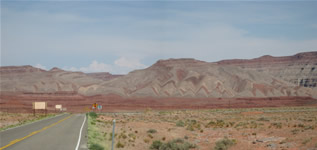
Talk about Painted Desert! Marvelous road-side vista near Mexican Hat, Utah
|
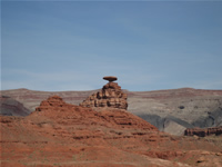
Mexican Hat
|
Take me back to the...
[Top]
|
|
Wednesday, July 26th
|
5 miles driven
|
Mather Campground, Grand Canyon, AZ (6:15)
--->
GC Backcountry Office (6:30)
--->
South Kaibab Trailhead (7:20)
--->
South Kaibab Trail
--->
Phantom Ranch, Grand Canyon, AZ (11:00)
--->
Bright Angel Campgorund, Grand Canyon, AZ (11:15)
|
|
|
Weather: Hot and sunny with afternoon clouds
I wake up early to get my stuff packed up for the hike down into the canyon.
Having remembered everything but the quarters last night I take a shower this morning before taking the shuttle buses towards the South Kaibab trailhead.
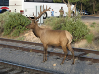
A big draw at the Backcountry Office in Grand Canyon Village is a herd of elk, which seem only marginally interested in the flurry of tourist activity.
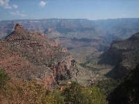
South Kaibab trail is a 10 mile relatively steep trail that leads down towards the bottom of the Grand Canyon and affords beautiful views across the splendor of the canyon along its entire length.
Despite being on my way a little later than planned the hike is very comfortable and I actually only need one 1 liter bottle of water on my 4 hour trek down.
It is really quite a bit hotter down here than on the rim, with record highs only beign prevented by the clouds that move in early in the afternoon.
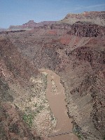
I reach the Black Bridge across the Colorado towards the Phantom Ranch at the bottom of the Canyon just before 11 and scope out a nice campsite at the Bright Angel CG right on the Clear Creek.
Phantom Ranch has a cantina that caters both to the folks staying at the ranch itself as well as to the campers, as well as an amphitheater at which an afternoon and an evening ranger program are held.
On one of my trips to buy myself a small snack at the cantina I cross a narrow foot bridge across the Clear Creek.
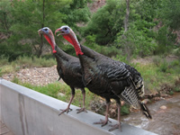
And that's when it happend. A pair of turkeys charge down the bridge side by side, screaming loudly and apparantly quite intent on preventing my passage.
Despite their menacing appearance and loud screams they do not appear to dare come closer than arms length.
Under the watchful but amused eyes of a ranger, they eventually fly onto the railing and allow me to finally get across the creek.
Later, in the afternoon ranger program, I learn that this particular ranger has also had some unfortunate episodes with these particular birds, and has been chased across the ranch himself.
After the afternoon program, in which the ranger answers all types of questions by the people that have made it all the way down, I do the short 1.5 mile bridge loop hike, which crosses both the Silver and Black Suspension bridges across the Colorado and leads past an ancient pueoblo dwelling, showing inhabitance of the area began many years ago.
The evening program is devoted to bats and scorpions, an apparant big favorite of this ranger, and using black light some scorpions are found as are some bats using a bat microphone.
After a beer at the cantina I head off into my tent. The heat makes it a little uncomfortable to sleep, but I do get enough rest for my trek back up to the rim the next day.
|
Backcountry Office Visitors
|
Good to go at the South Kaibab Trailhead
|
South Kaibab Trail Canyon Views
|
South Kaibab Trail Canyon Views
|
Mule Convoy on South Kaibab Trail
|
Panoramic view from the South Kaibab Trail near Skeleton Point
|
South Kaibab Trail down the Canyon...
|
...a trail with a view
|
First glimpse of the Colorado River
|
The Silver Bridge across the Colorado River...for the retun tomorrow
|
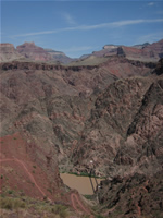
The Black Bridge across the Colorado River
|
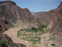
The Phantom Ranch, on a tributary to the Colorado River
|
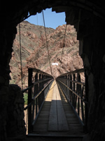
Almost there! The Black Bridge across the Colorado River towards Phantom Ranch
|
The Turkey Attack
|
Take me back to the...
[Top]
|
|
Thrusday, July 27th
|
129 miles driven
|
Bright Angel CG, Grand Canyon, AZ (5:50)
--->
Bright Angel Trail, Grand Canyon, AZ
--->
Grand Canyon South Rim, AZ (10:20)
--->
GC Backcountry Office, Grand Canyon, AZ (12:30)
--->
Cameron, AZ (3:00)
--->
Flagstaff, AZ (4:20)
|
|
|
Weather: Hot and sunny
As recommended by the rangers I and most of the other folks hiking out today start the day early.
I get up at 4:45 and am on my way up the Bright Angel Trail by 5:20.
Unlike the people that stay at the Phanotm Ranch, who have meals (breakfast as well) included, my breakfast is a bagle I bought at the Cantina the night before.
In comparison to the South Kaibab Trail, the Bright Angel Trail is longer ast 14 miles, but also flatter, which makes it the preferred route to ascend back to the South Rim.
I make good progress, with the only notable event being almost stepping on a black-and-white snake just past the Indian Garden Campground.
The last mile gets really hard though, even though the trail is in good shape and not even very steep or difficult.
Together with a french couple that also stayed down at the CG last night, we make it to the top, and in the very good time of 4.5h.
After treating myself to an ice cream and purchasing some drinks for the road, I head to the Mather CG showers to freshen up.
After a truly memorable stay at the GC, I head out of the park the way I came.
Taking another break in Cameron, I finally decide that I am really too tired to try to make the planned drive to Canyon de Chelley.
Sadly, once again, I have to postpone visting this much touted beauty to another trip and head south towards Flagstaff, AZ.
|
Bright Angel Trail Views
|
Bright Angel Trail Views
|
Indian Garden Flora
|
Indian Garden Ranger Station
|
Indian Garden Snake
|
Bright Angel Trail Views
|
Near the top, looking back at the canyon and the Bright Angel Trail
|
Back on the rim, sweaty, tired but very happy!
|
Take me back to the...
[Top]
|
|
Friday, July 28th
|
330 miles driven
|
Flagstaff, AZ (10:00)
--->
Sunset Crater/Wupatki National Monument, AZ (11:00-1:30)
--->
Flagstaff, AZ (2:30-3:30)
--->
Lake Havasu City, AZ (7:45)
|
|
|
Weather: Hot and sunny with a heavy mid-afternoon t-storm
I'm checked out of the motel and on the road towards the Sunset Crater/Wupatki National Monuments at 10 today.
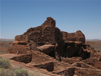
Sunset Crater is the youngest volcano on the Colorado Plateau, dating back to an eruption 900 years ago.
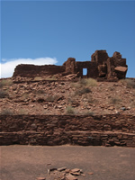
Nearby lies Wupatki Pueblo, which at a time was the tallest, largest, and perhaps the richest and most influential pueblo around.
Several ruins remain, which were at one time home to up to 100 people.
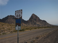
Heading back through Flagstaff for lunch I drive west on I40 towards Kingman.
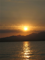
Here I take the scenic byway of Route 66 towards the southwest and I head towards Lake Havasu City.
I had planned to camp by the lake, but after learning at a gas station that temperatures don't really frop far below 100 degrees over night either, I choose a Motel 6 instead.
|
Sunset Crater, Cinder Hills Overlook
|
Wupatki Pueblo
|
Wupatki Pueblo
|
Wupatki Pueblo
|
Route 66
|
Route 66
|
Lake Havasu Sunset
|

Lake Havasu Sunset
|
Take me back to the...
[Top]
|
|
Saturday, July 29th
|
269 miles driven
|
Lake Havasu City, AZ (9:15)
--->
Amboy Crater, CA (11:20-1:00)
--->
Twentynine Plams, CA (2:15-3:00)
--->
Joshua Tree National Park, CA (3:00-4:30)
--->
Palm Springs, CA (5:30)
|
|
|
Weather: Hot and sunny
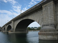
I begin my day at 7:30 and after checking out of the motel I head towards London Bridge.
London Bridge is in fact the very bridge that, accroding to the kids song, was falling down.
It was built in London in 1831 and couldn't handle the ever-increasing flow of traffic across the Thames River.
The British government decided to put the bridge up for sale in 1962, and Robert McCulloch, Founder of Lake Havasu City, Arizona, and Chairman of McCulloch Oil Corporation, submitted the winning bid of $2,460,000.
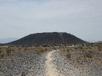
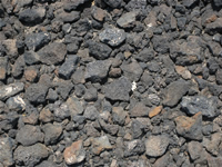
I leave Arizona for California via I40 and head for Amboy. Amboy is hardly a town, but located close to a 250ft high volcanic cinder cone crater formed around 6000 years ago.
I take a roughly 2 hour hike to the rim and into the crater before continuing south towards the town of Twentynine Palms and into Joshua Tree National Park.
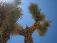
Joshua Tree is not only home to its namesake cactus, but also preserves a vast number of other desert cacti and landscapes.
Merely stopping at several viewpoints along the road and just a brief hike into an area featuring a veritable forest of cholla cacti, I exit the park at teh south and make my way towards Palm Springs, where I plan spend the next two days at the pool.
|
London Bridge/Lake Havasu City
|
Amboy Crater
|
Amboy Crater
|
Amboy Crater
|
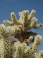
Cholla Cactus in Joshua Tree National Park
|
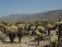
Cholla Cactus in Joshua Tree National Park
|
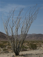
Ocotillo in Joshua Tree National Park
|
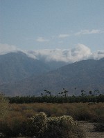
The San Bernardino mountains, western boundary to Palm Springs
|
Take me back to the...
[Top]
|
|
Sunday, July 30th
|
25 miles driven
|
Palm Springs, CA
|
|
|
Weather: Hot and sunny
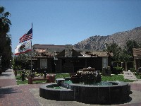
Today I get up relatively early again at 7:30, but pretty much just to get started on a day doing nothing. :-)
I spend most of the day at the pool, relaxing and enjoying the sun, and only venture into downtown Palm Springs for a few hours around noon for a little sightseeing and lunch.
|
Palm Springs cloud barrier
|
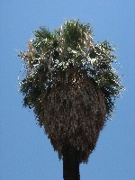
Palm Springs...uhm, palm tree
|
Downtown Palm Springs
|
Downtown Palm Springs - the spring part? :-)
|
Take me back to the...
[Top]
|
|
Monday, July 31st
|
370 miles driven
|
Palm Springs, CA (12:00)
--->
Victorville, CA
--->
San Luis Obispo, CA
|
|
|
Weather: Hot and sunny
The day begins at 7:30 and I spend the morning still relaxing at the pool.
After checking out at noon I begin to make my way towards the California coast.
Just north of Palm Springs lies the San Georgonio Pass of the San Bernardino Mountains.
It is home to the third largest concentration of wind turbines in Califonia and its 3500 turbines provide enough power for Palm Springs and the entire Coachella Valley.
Stopping to get gas just before getting onto I10 the strong winds (with added dust) make it clear why this is a good place for wind power generation but probably not an ideal place to stop and get gas. :-)
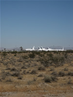
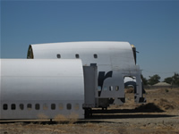
I head west on I10 and then north on I15 for a little detour towards Victorville, or rather Adelanto.
At an airfield here a large number of commercial aircraft are stored or retired due to the favroable weather conditions here.
Only relatively distant views through a fence are possible, but 727, 747, DC8s and L1011 are large aircraft, so they are quite visible.
Also nearby is an aircraft graveyard, which has the broken up fuselage of a former Tower Air 747 among other things.
I abandon my plan to do more aircraft spotting at Palmdale and Mojave, unfortunately, and head west through Santa Clara towards the coast at Ventura.
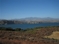
The views while driving north along the caost on highways 101 and 1 are really quite beautiful, as is the Cachuma Recreation Area on highway 154.
I set up camp for the night near the coastal town of San Luis Obispo.
|
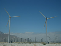
San Georgonio Pass Wind Turbines
|
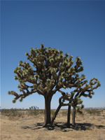
Joshua Tree near Victorville
|
Joshua Tree near Victorville
|
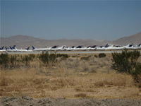
Desert aircraft storage near Victorville
|
Joshua Tree near Victorville
|
Desert aircraft storage near Victorville
|
Airplane graveyard near Victorville
|
Cachuma Lake
|
Take me back to the...
[Top]
|
|
Tuesday, August 1st
|
282 miles driven
|
San Luis Obispo, CA (1:20)
--->
San Simeon, CA
--->
Palo Alto, CA (7:00)
--->
San Francisco, CA (8:30)
|
|
|
Weather: Cool yet sunny on the coast
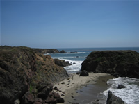
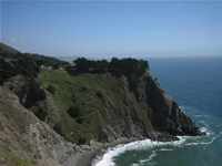
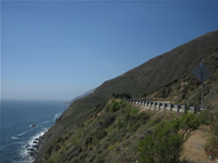
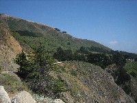
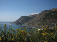
I enjoy another slow morning and hit the road at 1:30, driving north on highway 1.
Highway 1 is truly a beautiful and fun drive and the views of the coastline and the Pacific truly breathtaking.
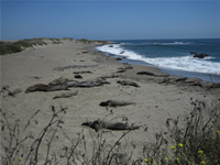
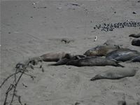
Near San Simeon a colony of elphant seals lazily lies on the beach, and I join the many sighsteers in watching them do nothing for a while.
Heavy traffic and a high fee dissuade me from driving through Monterey, so instead I head north towards San Francisco, where I will spend my last night on the west coast for this trip at a downtown Howard Johnson Motel.
|
California Coast along Highway 1
|
California Coast along Highway 1
|
Elephant Seals
|
Elephant Seals
|
California Coast along Highway 1
|
California Coast along Highway 1
|
California Coast along Highway 1
|
California Coast along Highway 1
|
Take me back to the...
[Top]
|
|
Wednesday, August 2nd
|
133 miles driven
|
San Francisco, CA
--->
Sacramento, CA
|
|
|
Weather: Hot and sunny
The last vacation day has arrived. I have breakfast on the steps of city hall before I finally get around to driving my Chevy through a car wash to at least remove the worst of the desert dust and mud.
After checking out I drive around San Francisco for a little sightseeing and finally head towards Sacramento via the Golden Gate Bridge.
Before returning the car to Alamo at the airport I still enjoy a beautiful if warm evening in Old Sacramento.
|
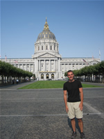
City Hall
|
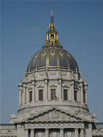
City Hall
|
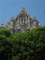
Mission Dolores
|
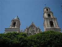
Mission Dolores
|
Golden Gate Bridg
|
Golden Gate Bridg
|
Sacramento Railroad Museum
|
The Farewell Shot
|
Take me back to the...
[Top]
|
|
|
|

)
)
)
)
)
)
)
)
)
)
)
)
)
)
)
)
)
)
)
)
)
)
)
)
)
)
)
)
)
)
)
)
)
)
)
)
)
)
)
)
)
)
)
)
)
)
)
)
)
)
)
)
)
)
)
)
)
)
)
)
)
)
)
)
)
)
)
)
)
)
)
)
)
)
)
)
)
)
)
)
)
)
)
)
)
)
)
)
)
)
)
)
)
)
)
)
)
)
)
)
)
)
)
)
)
)
)
)
)
)
)
)
)
)
)
)
)
)
)
)
)
)
)
)
)
)
)
)
)
)
)
)
)
)
)
)
)
)
)
)
)
)
)
)
)
)
)
)
)
)
)
)
)
)
)
)
)
)
)
'))
)
)
)
)
)
)
)
)
)
)
)
)
)
)
)
)
)
)
)
)
)
)
)
)
)
)
)
)
)
)
)
)
)
)
)
)
)
)
)
)
)
)
)
)
)
)
)
)
)
)
)
)
)
)
)
)
)
)
)
)
)
)
)
)
)
)
)
)
)
)
)
)
)
)
)
)
)
)
)
)
)
)
)
)
)
)
)
)
)
)
)