|
|
|

|
Southwest USA 2005
July 10th - July 27th 2005
|
|
|
|
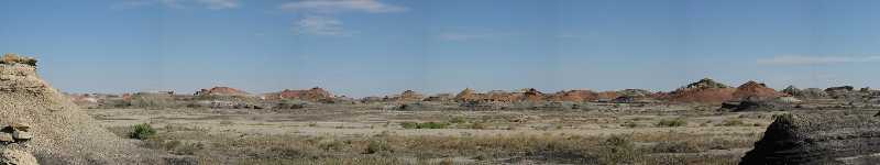
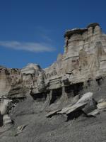
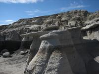
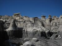
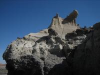
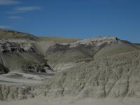
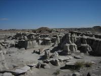
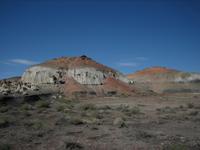
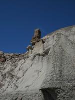
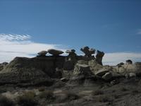
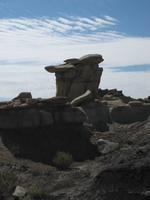
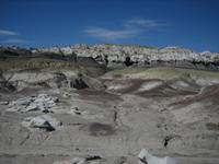
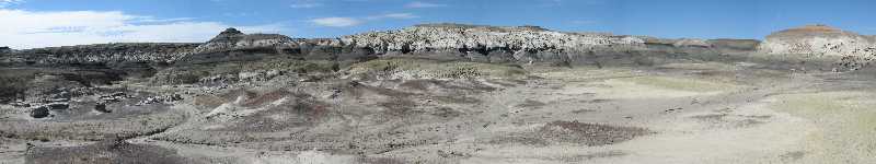
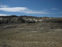
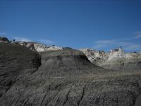
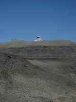
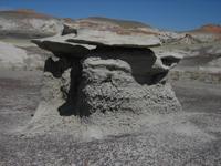
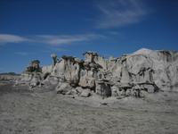
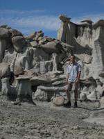
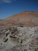
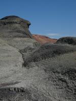
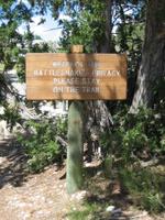
Bisti Badlands Wilderness Area, located in northwestern New Mexico about 30 miles south of the city of Farmington, is a little known area of beautifully unusual scenic badlands, administered by the BLM.
It is best reached driving south on highway 371 from Farmington for 34 miles and then turning onto the dirt road CR7297. After a about a two mile drive the road ends in a T-intersection, and after tuning left the parking lot and trailheaad for the Bisti Wilderness area is reached after about another 2 miles.
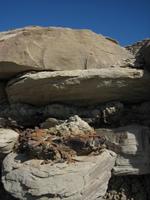
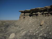
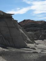
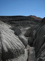
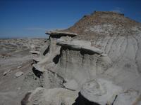
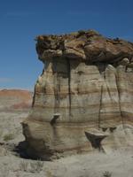
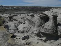
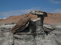
It's hard to describe the other-worldly, steeply eroded badlands topography that surrounds the hiker upon entering the area through the Gateway Wash.
And the absence of any meaningful captions on my pictures below reflects that as well.
Spending a few hours to hike through this bizarre and colorful landscape is a truly memorable experience though, and all the BLM asks of the visitor is to respect the surroundings and to leave no trace.
|
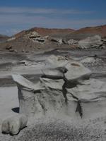
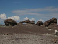
Bizarre, beautiful and colorful Bisti
|
Bizarre, beautiful and colorful Bisti
|
Bizarre, beautiful and colorful Bisti
|
Bizarre, beautiful and colorful Bisti
|
Bizarre, beautiful and colorful Bisti
|
Bizarre, beautiful and colorful Bisti
|
Bizarre, beautiful and colorful Bisti
|
Bizarre, beautiful and colorful Bisti
|
Bizarre, beautiful and colorful Bisti
|
Bizarre, beautiful and colorful Bisti
|
Bizarre, beautiful and colorful Bisti
|
Bizarre, beautiful and colorful Bisti
|
Bizarre, beautiful and colorful Bisti
|
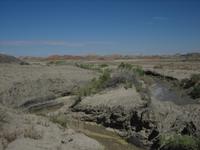
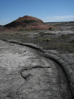
After yesterdays storms, water actually flows in parts of the Gateway Wash in Bisti
|
Bizarre, beautiful and colorful Bisti
|
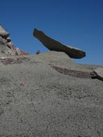
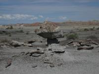
Winged Rock
|
Bizarre, beautiful and colorful Bisti
|
Bizarre, beautiful and colorful Bisti
|
Bizarre, beautiful and colorful Bisti
|
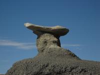
Winged Rock
|
Bizarre, beautiful and colorful Bisti
|
Bizarre, beautiful and colorful Bisti
|
Bizarre, beautiful and colorful Bisti
|
Bizarre, beautiful and colorful Bisti
|
Winged Rock
|
Bizarre, beautiful and colorful Bisti
|
Bizarre, beautiful and colorful Bisti
|
Bizarre, beautiful and colorful Bisti
|
Bizarre, beautiful and colorful Bisti
|
Bizarre, beautiful and colorful Bisti
|
Bizarre, beautiful and colorful Bisti
|
Bizarre, beautiful and colorful Bisti
|
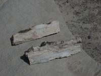
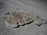
Petrified logs, evidence of the areas once lush vegetation
|
Bizarre, beautiful and colorful Bisti
|
Bizarre, beautiful and colorful Bisti
|
Bizarre, beautiful and colorful Bisti
|
Bizarre, beautiful and colorful Bisti
|
Bizarre, beautiful and colorful Bisti
|
|
|
|
|
|
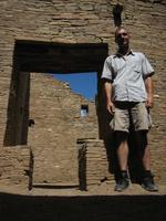
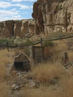
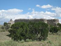
Chaco Culture National Historical Park is located in northwestern New Mexico between highways US371 and US550 (formerly NM44).
It is best reached by taking Country Road CR7900 for 5 miles, which heads off in western directions from US550, and dirt road CR7950 for another 16 miles to the park boundary.
Chaco preserves another important area in North American cultural heritage.
The Chaco Canyon region was a major center of ancestral Puebloan culture between AD 850 and 1250, and the monumental public and ceremonial buildings unearthed at the site allude to the areas importance as a cultural, ceremonial and economic hub of the San Juan Basin.
The fantastic structures, often oriented in astronomically significant directions, as well as remnants of an extensive road network all underline the advanced nature of the Puebloan civilization.
Ranger led tours are available and can be booked at the visitors center, while the ruins can also be explored freely, many being easily reached from the parks paved loop road.
Hikes of varying length are also a great way to appreciate the impressive architectural achievements, with some requiring back country permits.
The price of admission is $8 per vehicle and week, with the fee included in the National Parks Pass.
|
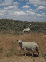
Sheep grazing just outside Chaco Culture National Historical Park
|
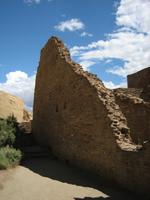
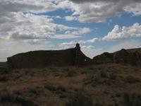
Hungo Pavi Ruins, inhabited from 1000-1250
|
Hungo Pavi Ruins, inhabited from 1000-1250
|
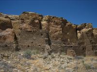
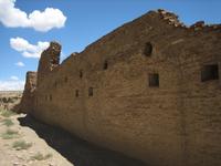
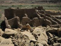
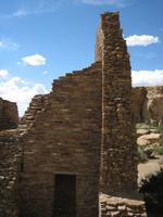
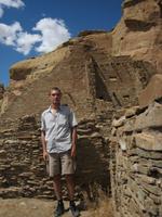
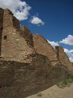
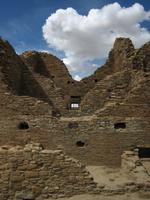
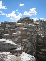
Chetro Ketl Ruins, the second largest Chacoan great house
|
Chetro Ketl was thought to be inhabited between 950 and 1250
|
Chetro Ketl Ruins covers more than 3 acres and had up to three stories
|
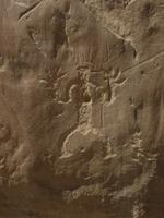
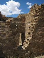
A few easily readable petroglyphs remain...
|
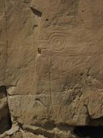
...on the rocks along the trail connecting Chetro Ketl and Pueblo Bonito
|
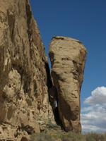
A likely future rock slide
|
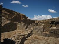
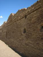
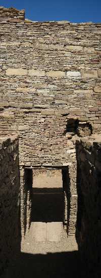
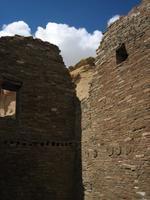
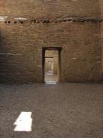
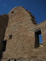
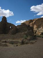
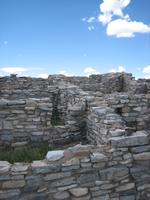
The Pueblo Bonito Ruins cover 3 acres
|
The variable thickness of the walls at Pueblo Bonito...
|
...indicates high skill in multi-story architecture
|
Pueblo Bonito was unearthed in several expeditions between 1920 and 1927
|
Pueblo Bonito had up to 800 rooms and was inhabited between 950 and 1140
|
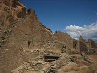
Pueblo Bonito Ruins was a Chacoan Great House...
|
...and is thought to have been a center of Puebloan culture
|
Pueblo Bonito was primarily a public house...
|
...serving ceremonial, administrative...
|
...as well as trading and storage purposes
|
Pueblo Bonito had up to 5 stories
|
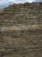
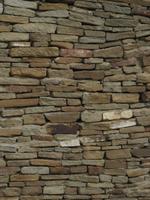
Masonry detail of Pueblo Bonito Ruins
|
Pueblo Bonito went through three major construction phases
|
The controversial Wetherhills are buried here
|
Masonry detail of Pueblo del Arroyo
|
Pueblo del Arroyo was another Chacoan Great House...
|
..and was inhabited between 1075 and 1250
|
|
|
|
|
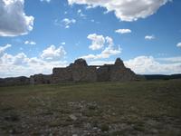
Spread across central New Mexico just southeast of Albuquerque are the three sites of the Salinas Pueblo Missions, which document the at time tumultuous early contact between the native Pueblo Indians and the Spanish Franciscans in the 17th century.
The park headquarters is located in the town of Mountainair along highway US60, and offers informative exhibits and information on the three park sites at Quarai, Abo and Gran Quivira. I visited the largest of these, Gran Quivira, also known as Las Humanas, which reached from Mountainair by driving 26 miles southeast on NM55.
The pueblo at this site was an important trade center and the collocated ruins of two churches, one of which abandoned even during its construction phase, offer an insight into the at times relatively peaceful coexistence of the Native Americans and the Spaniards and at other times quite violent clash of cultures and religions.
|
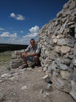
Grand Quivira, Salinas Pueblo Missions National Monument
|
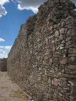
Situated on a knoll protruding from Chupadera Mesa...
|
...Grand Quivira was the largest of the Salinas Pueblos.
|
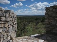
The site contains ruins of structures erected by the Pueblo Indians...
|
...as well as Spanish Franciscan missionaries.
|
Grand Quivira was an important trade center before and after the arrival of the Spaniards
|
The ruins include an uncompleted church...
|
...allowing a glimpse at the complicated and tumultuous relations between Indians and Spaniards.
|
|
|
|
|
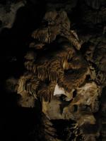
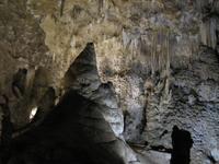
Carlsbad Caverns National Park, located in southeastern New Mexico and a 30 mile drive on highway US62 from the city of Carlsbad, was established as an NPS site in 1930 and designated a World Heritage Site in 1995, to preserve Carlsbad Cavern and more than 100 other known limestone caves in the area.
The caves lie in the Capitan Reef in the Guadalupe Mountains, a limestone mountain range recognized as the best-preserved Permian-aged fossil reef in the world.
In the absence of rivers or streams in this region, a relatively unique mechanism in limestone cave creation, called dissolution, based on sulfuric acid was at work in the Guadelupe Mountains.
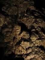
Then, in more recent geologic history, the spectacular cave decorations, called speleotherms, were and continue to be formed by rain and snow melt soaking through limestone rock and eventually dripping into and evaporating in the caves below.
The main attraction is Carlsbad Cavern and its Big Room, which is the most accessible of the caves and can be explored on a self-guided tour - also a great escape from the desert heat - either by walking in through the caves Natural Entrance or by taking an elevator down.
Another major attraction is the spectacle of the bat flight, which can be viewed from a purpose-built amphitheater at the caves Natural Entrance every day at sunset.
The visitor center offers exhibits as well as information and tickets on more adventurous tours of other caves in the area.
An entrance fee of $6 is charged per person for three days, waived upon presentation of the National Parks Pass.
Adding $3 for the hand-held audio guide is a good investment to learn more about the cave history and the spectacular limestone rock formations visible along the 1-mile path in the Big Room and the steep 1-mile Natural Entrance path.
|
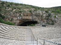
The Caverns Natural Entrance amphitheater for nightfall bat flight watching
|
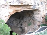
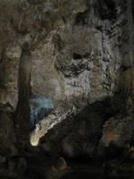
The Caverns Natural Entrance
|
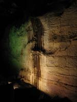
Decorated walls...
|
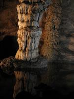
...elaborate speleotherms and quiet pools...
|
...line the steep path heading down...
|
...the caves Natural Entrance.
|
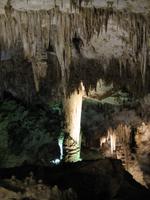
Many more imaginatively named rock formations...
|
...can be viewed from a 1-mile loop trail...
|
... through the Big Room...
|
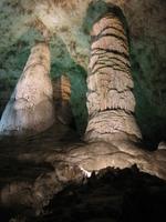
...which covers an area of 33,210 square meters.
|

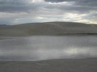
Mirror Lake | ekaL rorriM :-)
|
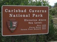
Carlsbad Caverns National Park
|
|
|
|
|
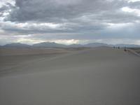
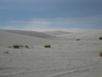
Nature has created another completely different attraction in the US Southwest, which is preserved in the White Sands National Monument, located in southern New Mexico 15 miles southwest of the city of Alamogordo on US70.
Covering an area of 275 square miles in a valley called the Tularosa Basin at the northern end of the Chihuahuan Desert is the worlds largest gypsum dune field.
The glistening white gypsum (hydrous calcium sulfate) that forms these unusual dunes originates from an ephemeral lake with a very high mineral content.
As the water evaporates, the minerals are left behind to form gypsum deposits that eventually are wind-transported to form these white sand dunes.
Truly a very different sight from the spectacular red rock formations and yellow deserts throughout the Southwest, the area can be explored up close driving along Dunes Drive, and visitors often have a blast sliding down the dunes.
More information about the park other activities, such as a sunset dunes walk, can be obtained in the parks visitors center right on US70.
An admission fee of $3 is charged per person for seven days, which is not charged for owners of the National Parks Pass.
|
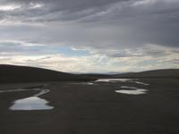
Midday t-storms have created puddles on the road between the dunes
|
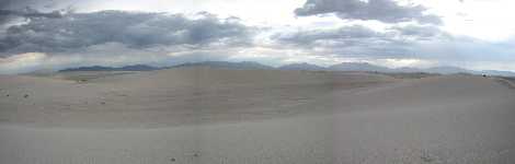
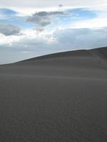
Panoramic view across the gypsum dunes at White Sands NM under grey skies
|
People enjoying the dunes despite the recent rain
|
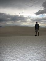
...and they are indeed still impressive and fun despite the weather
|

White gypsum roads lead through a portion of the white gypsum dunes
|
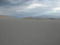
A break in the clouds reveals a little of the gypsum sands white color
|
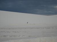
This bird very animatedly was on the prowl for food after the rains
|
But rain is an essential ingredient...
|
...for the existence of White Sands...
|
...supplying dissolved gypsum for the dunes.
|
|
|
|
|
|

)
)
)
)
)
)
)
)
)
)
)
)
)
)
)
)
)
)
)
)
)
)
)
)
)
)
)
)
)
)
)
)
)
)
)
)
)
)
)
)
)
)
)
)
)
)
)
)
)
)
)
)
)
)
)
)
)
)
)
)
)
)
)
)
)
)
)
)
)
)
)
)
)
)
)
)
)
)
)
)
)
)
)
)
)
)
)
)
)
)
)
)
)
)